Conondale Range Great Walk - track notes
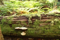
 The Conondale Ranges in the Sunshine Coast hinterland in southeast Queensland have long been a conservation focus due to their enormous biodiversity. Since 1966 there has been strong local and conservation pressure for a sizeable National Park and this has incrementally led to the establishment of the 35 500 ha Conondale National Park. Up until recently, access to the Conondales has been restricted to some small circuit walks from the popular campgrounds of Charlie Moreland Park or Booloumba Creek and a Forest Circuit drive which linked the two.
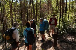
The recently-opened Conondale Range Great Walk now provides an excellent way for walkers to experience at first hand, the rugged and varied beauty of the area.
When to go
While the walk can be done all year round, it is probably best to avoid rainy or hot conditions. Apart from the presence of leeches in wet weather, it is important to realise that rising levels in Booloumba Creek can cut off access to the world outside, leaving one stranded for several days. Spring and autumn are generally excellent times but paying heed to weather forecasts is vital.
Safety warnings
The usual safety warnings apply, not walking alone, knowing exit points, letting others know your plans and avoiding flooded creek crossings. Two additional warnings specific to the Conondales are that rocks in the gorges, particularly around the Breadknife, can become treacherously slippery when wet and that the cliffs around Summer Falls are unfenced and dangerous. More specific warnings are contained on the Conondale Range Great walk topographic map which is an absolute essential, not just for safety but for the mass of geographic and biological information it contains.
Access
The Conondale Range Great Walk is located in the Conondale National Park, an hours drive west of the Sunshine Coast or a two-hour drive north-west from Brisbane. The walk is a circuit which begins and ends at the Booloumba Creek day use area. Access is from the Kenilworth-Maleny Road, seven kilometres south of Kenilworth then six kilometres along Booloumba Creek Road.
There are three creek crossings on the road that brings you in to the start of the walk. Signage indicates they are suitable for four-wheel drive vehicles only. While the first two are sometimes negotiated by high clearance, two wheel drive vehicles (depending on conditions), the third can prove quite treacherous.
Camping
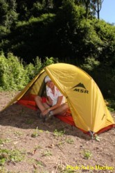 Permits are needed to camp in all national parks in Queensland and this needs to be sorted out before you begin. There are three overnight campgrounds on this walk and each compromises six campsites (up to 4 people per site), bench tables, a toilet and access to untreated drinking water. Campfires are prohibited at the walkers’ camps. Camping permits can be obtained from www.qld.gov.au/camping or 131304.
Maps
The Great Walk! Conondale Range topographic map is full of information to make your walk safer and more enjoyable. As well as very detailed track notes, with many species identified, it contains a handy transect map which gives a better understanding of differences in elevation experienced on the walk. It is available from www.derm.qld.gov.au/greatwalks or local information centres and shops for $7-90.
Safe Car Parking
Pre-arrange transport to and from the start of Great Walk
Phone Pete: 5446 0211 Bellbird Tea House
Further reading
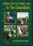
Although published several years before the opening of the great walk, “Walking on the Wilder Side… In The Conondales” is a veritable mine of information on the area. Published by the Conondale Range Committee, it explores the history and biodiversity of the Conondales as well as containing information on additional walks. It is available for $20 from www.exploreconondales.com or local bookshops.
Booloumba Falls
WALK AT A GLANCE
Distance: 56 kilometres/four days return
Grade: Moderate (Class Three to Four)
Nearest Town: Kenilworth
Access: One hour west of Sunshine Coast, two hours north-west from Brisbane
Day 1
Booloumba Creek day use area to Wongai walkers’ camp (11km, allow 6hrs)
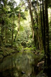
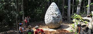
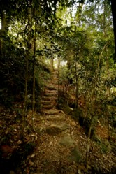
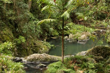
 Travel upstream, never far from Booloumba creek through rainforest featuring unique bunya pines, piccabeen palms and vine forests, dwarfed by tall flooded gums. Cross the creek at Artist’s cascades and prepare for a rather rapid ascent out of the gorge, through completely different vegetation communities. Look out for attractive pure white Christmas Orchids (Calanthe triplicata) growing in the moister understory during the summer months. A branch track takes you to the breadknife and Booloumba falls and it’s well worth taking. The breadknife is an impressive rock formation which marks the junction of peters and Booloumba creeks. Back on the Great Walk track, Wongai walkers’ camp is just a few kilometres away and located near the site of an earlier scientific research station.
Day 2
Wongai to Tallowwood walkers’ camp (17 km, allow 8hrs)
This is the longest section of the walk so be sure to allow plenty of time. It climbs steadily through rainforest, wet sclerophyll, and open forest, along old logging roads and fire management trails to reach some of the highest country in the Conondales, around Mt Gerald and Mt Langley. From here the track skirts the very headwaters of Booloumba, Bundaroo and Peters Creeks and marks the divide between the Mary River and Stanley River catchments. Wongai, aboriginal for Carpet Python (Morelia spilota) can often be seen sunning itself along the track.
Day 3
Tallowwood to Summer Falls walkers’ camp (15.2km, allow 7 hrs)
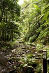
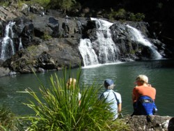
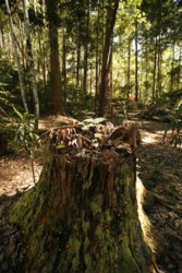
 The track descends gradually through wet sclerophyll and rainforest towards Peters Creek to a small spur track to Peters Falls. This section of the walk contains ample evidence of the Conondales logging past, an old log hauling arch can be seen not far from the campground as well as numerous loading ramps at the side of the track. Much of the trail here is much wider, utilising old logging trails. The trail crosses Sunday Creek Road (beware of vehicles) and descends through more open forest finding, and following, the beautiful rock pools of Summer Creek. The placid Summer Creek gives way dramatically to the impressive Summer Falls and it is near these that the third campground is located.
Day 4
Summer Falls to Booloumba Creek day use area (12km, allow 6.5hrs)
The last day’s walk begins with a steady climb through dry open and wet sclerophyll forests climbing up towards Mt Allan. A feature to look out for is the unusual Iron Bark orchid, Dendrobium aemulum which grows in the rough bark of Eucalyptus crebra. Stunning views can be enhanced by climbing the Mt Allan fire tower (built 1954, restored 2008) from which the walker see stunning panoramic views and much of the area they’ve spent the last three days traversing. From here the track winds downhill, again through varying forest types, back to the Booloumba Creek day use area… where it all began, four days previously.
Shorter walking options
As well as the four-day walk there are a number of shorter walks utilising part of the Great Walk trail.
- Booloumba Creek day use area to Gold Mine (5km return, allow 2.5hrs)
- Booloumba Creek day use area to Artists Cascades (10.6km return, allow 4 hrs)
- Booloumba Creek day use area to Mt Allan fire tower (11km return, allow 4.5 hrs)
- Peters Pool
New Great Walk opens window into the Conondales
The recently-opened Great Walk Conondale Range is a trip back in time in more ways than one. The 56-kilometre circuit walk which begins and ends at the popular Booloumba Creek day use area provides much more than a glimpse of the spectacular forests, creeks and gorges for which the Conondale Ranges have become noted.
While the walk includes three new walkers’ campgrounds and is intended as a four-day experience, it also provides the opportunity for a number of shorter walks as well.
When opening the walk in early July, the Acting Minister for Climate Change and Sustainability explained it was the sixth of the state’s great walks and declared “ they had left the best till last”.
While other great walks like those at Cooloola and the Blackall Range offer a diversity of experiences for the walker, the new Conondales walk brings with it decades of history of forestry, community and conservation involvement.
In 1966 Kenilworth scoutmaster, Ross Scott, door-knocked Kenilworth with a petition for a National Park in the Conondales, but, though unanimously supported locally (even by the local branch of the Country Party), it was shelved by the state government.
The Save the Conondale Range Committee was established in 1976 following the work of a number of young researchers who were more than impressed with the areas unique flora and fauna, most notably the Gastric Brooding Frog Rheobatrachus silus. There was great urgency in these early days, as the lowland rain and vine forest around Little Yabba Creek was being cleared and the whole area was ear-marked for felling to make way for pine plantations.
Now, more than four decades on, Ross Scott’s original National Park proposal has been more then realised with a large area of 35 500 hectares having been progressively declared. Sadly Rheobatrachus isn’t around to see it. The last one was sighted in the early 80s and is generally considered to be extinct, one of a number of victims of the introduced Chytrid fungus.
 To wander the newly created trails is to walk back through time. The tree fern gullies and mountain creeks suggests links to our Gondwanan origins when such forests were far more widespread. They speak of our indigenous forebears heading up the waterways laying lobster traps as they went, for mountain lobster were highly prized.
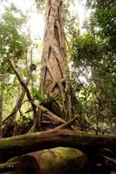
Other sections speak more loudly of a forestry past. The walk out from Peters Creek, in particular, takes you past old log-loading ramps and giant stumps from, many of which have re-shot, and much of the walk utilises old forestry tracks, now being reclaimed by forest. While the views from the Mt Allan fire tower are spectacular, the walker is reminded that the tower is but one of a network (including the iconic Jimna Fire Tower) built to protect the forest estate from unplanned fires.
About the author
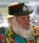 Ian Mackay has been President of the Conondale Range Committee for “quite a long time”, a keen walker who truly appreciates the natural wonders of the Conondales.
He readily acknowledges the work of all those who laid down the groundwork for the recognition of the Conondale Range’s natural wonders and who’ve worked so selflessly to see them properly recognised and protected. Formed in 1976, the Conondale Range Committee is one of the Sunshine Coast’s longest-serving conservation groups and has been recognised with two environment awards.
Peters Creek